
1
/
of
5
cacheantiquessydney
Large and Rare 18th c. English Map of Africa
Large and Rare 18th c. English Map of Africa
Regular price
$546.00 USD
Regular price
Sale price
$546.00 USD
Unit price
/
per
Shipping calculated at checkout.
Couldn't load pickup availability
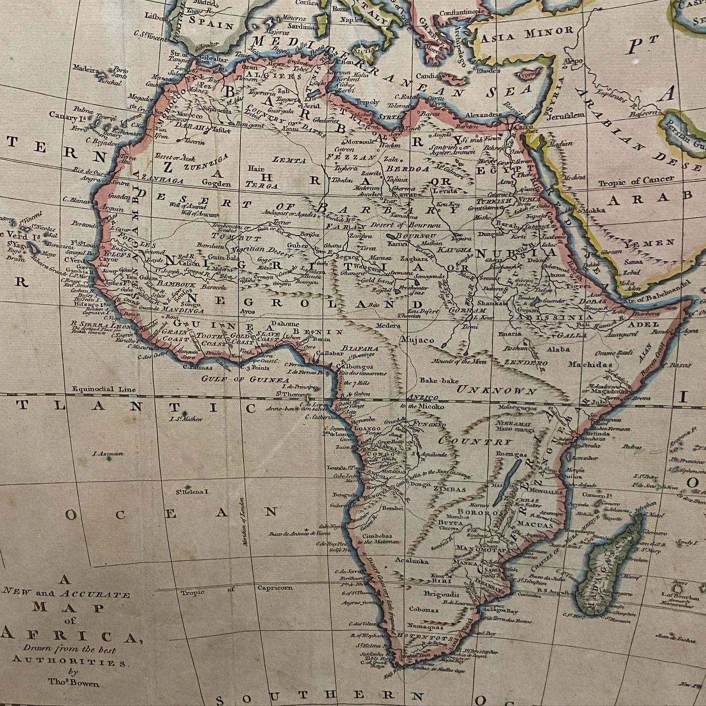
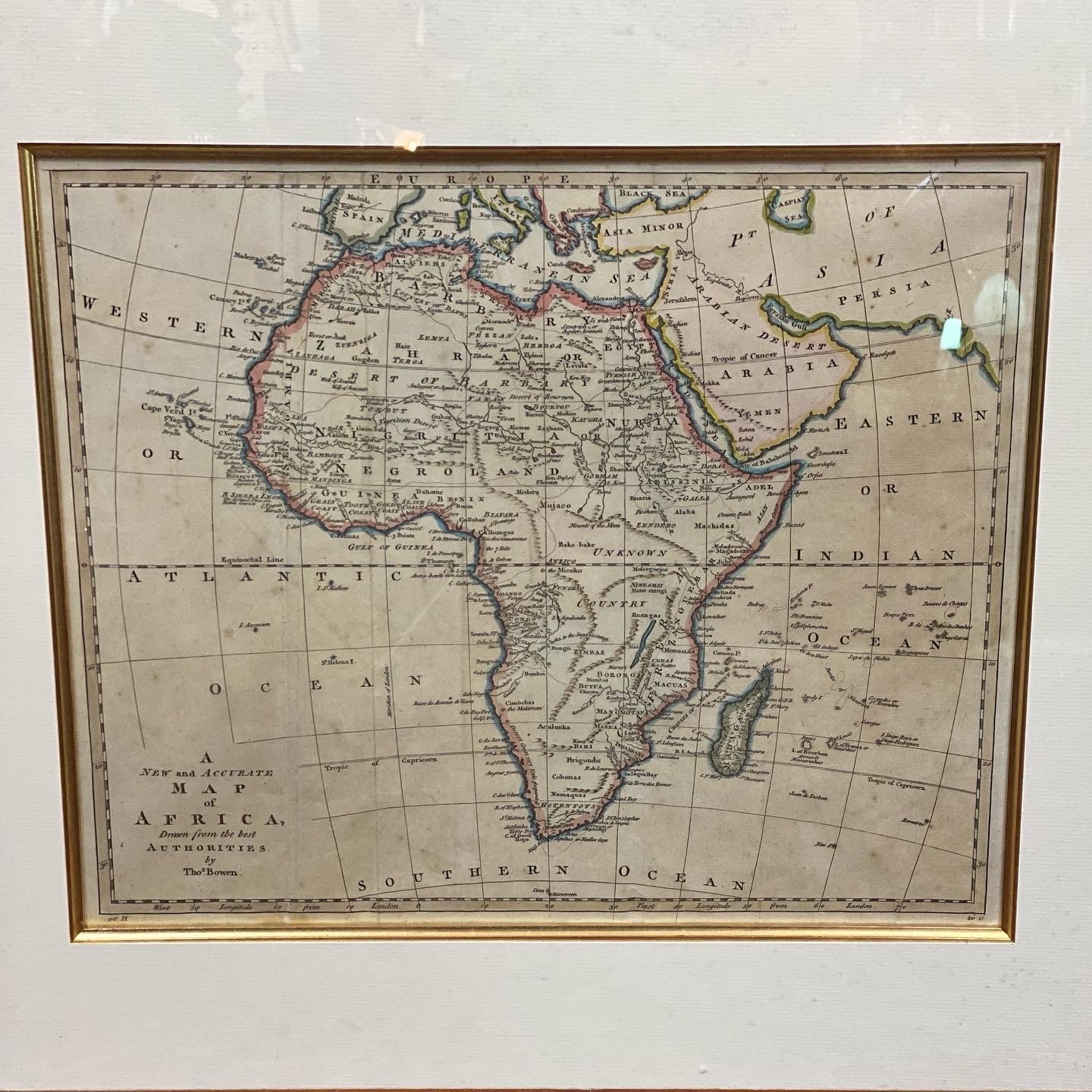
This large 18th c. English map depicting Africa is a fascinating record not only of the continent itself but also European understanding (as limited as that was) of this vast and unexplored land.
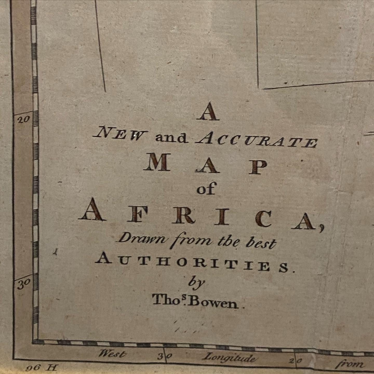
The caption in the lower left corner indicates the map was drawn by Thomas Bowen (b. c. 1733 - March 1790), who was an English engraver, mapmaker, and printseller.
This would have represented multiple expeditions’ cartographic results as European interest in Africa was aroused in the 1830s, culminating in the Scramble for Africa in the 1880-1910s.
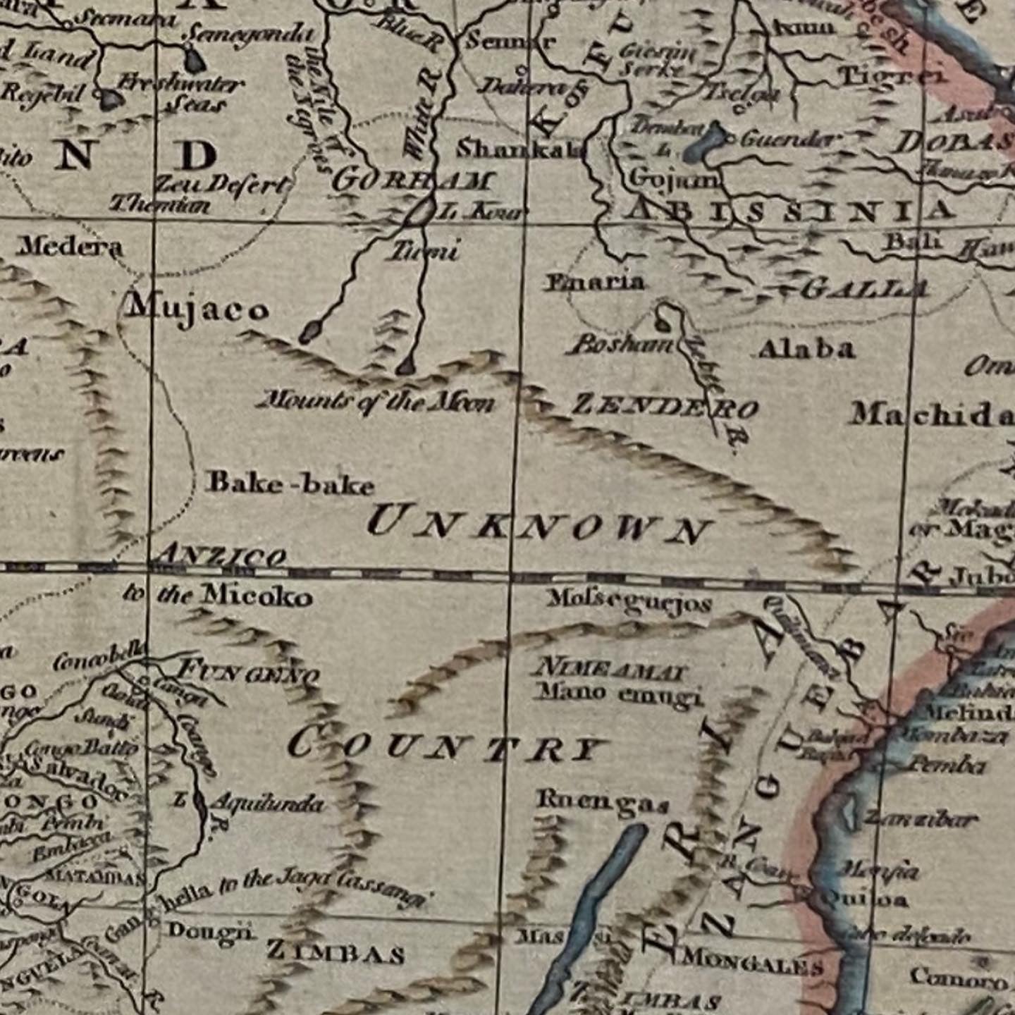
Particularly of note is the use of antiquarian terms such as Ptolemy’s “Mounts of the Moon”, a semi-mythical area believed to enclose the source of the Nile. It should also be noted that the map depicts one of the last “blank spots” of the world; a spot hitherto unexplored (and which would only be mapped in the 19th century). These captions further underscore the different attitudes of the time, as well as evoke airs from “the Age of Discovery”.
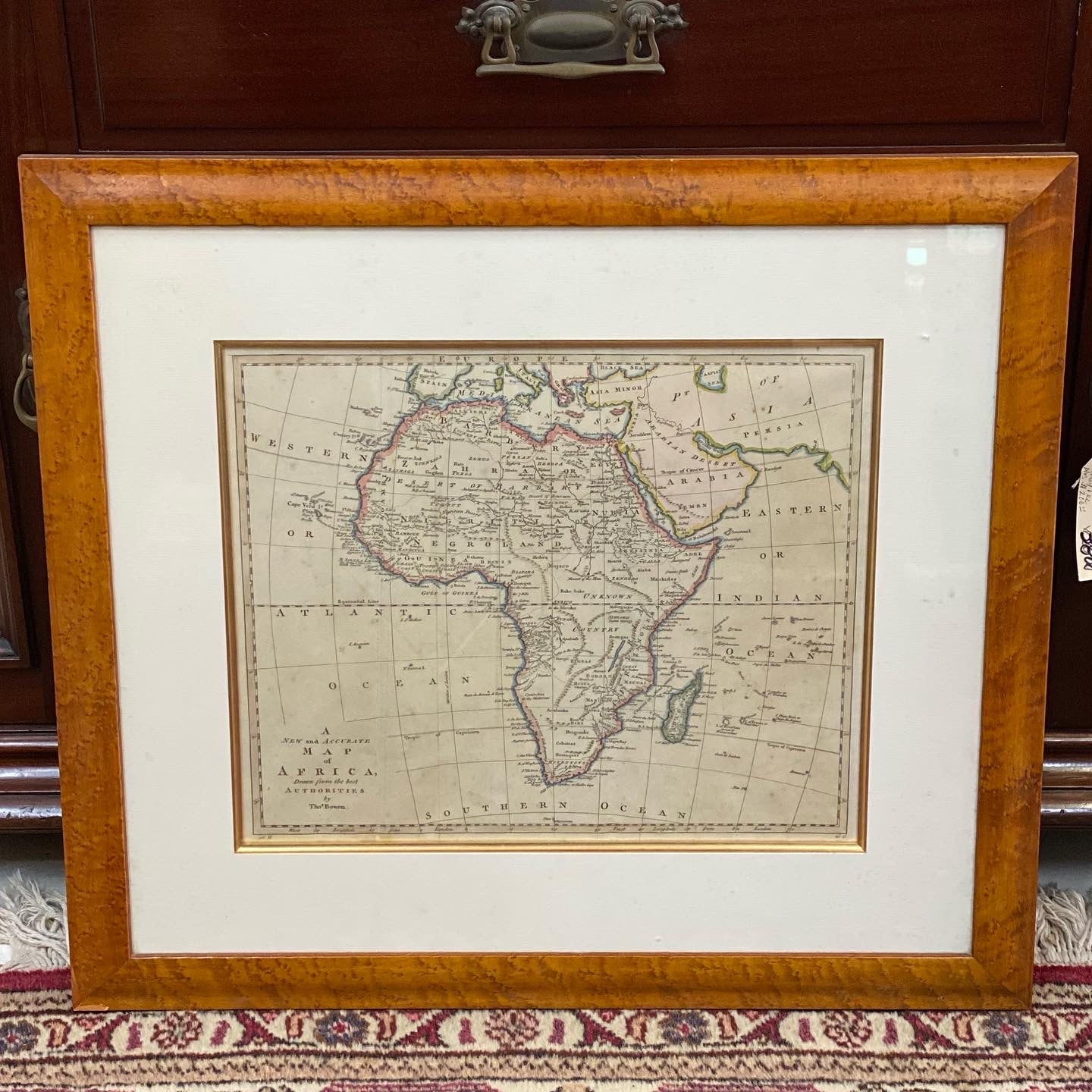
There is wear and loss to frame in the lower left corner, but the print itself is in excellent condition as is the rest of the frame. With this in mind and the rarity of the print, this map is fairly priced at $770AUD.
Frame dimensions: 67 cm wide by 59 cm high.
Map dimensions: 42 cm wide by 34 cm high
The caption in the lower left corner indicates the map was drawn by Thomas Bowen (b. c. 1733 - March 1790), who was an English engraver, mapmaker, and printseller.
This would have represented multiple expeditions’ cartographic results as European interest in Africa was aroused in the 1830s, culminating in the Scramble for Africa in the 1880-1910s.
Particularly of note is the use of antiquarian terms such as Ptolemy’s “Mounts of the Moon”, a semi-mythical area believed to enclose the source of the Nile. It should also be noted that the map depicts one of the last “blank spots” of the world; a spot hitherto unexplored (and which would only be mapped in the 19th century). These captions further underscore the different attitudes of the time, as well as evoke airs from “the Age of Discovery”.
There is wear and loss to frame in the lower left corner, but the print itself is in excellent condition as is the rest of the frame. With this in mind and the rarity of the print, this map is fairly priced at $770AUD.
Frame dimensions: 67 cm wide by 59 cm high.
Map dimensions: 42 cm wide by 34 cm high
Shipping & Returns
Shipping & Returns
Share